- INTRODUCTION
Under Republic Act No. 9003 otherwise known as the Ecological Solid Waste Management Act, all dumpsites will be closed or open dumping and controlled dumpsite will all be prohibited. A Solid Waste Management Plan will be formulated to come up with a system for the reduction of wastes and strict implementation of the plan. Considering the pressure of the directive by the EBCB/ DENR as well as the Ombudsman, the need to urgently formulate a Municipal Ecological Solid Waste Management Plan.
1.1. Purpose
The Municipality’s vision related to Solid Waste Management is to be able to adopt and implement the provisions of RA 9003. One major issue in the implementation of RA 9003 is the social acceptability of the community. Another is the necessity to undertake an extensive information education campaign as well as the dedication and initiative of concerned officials/sectors/other agencies.
The intent of RA 9003 and its effect on Solid Waste Management is very vital especially on segregation at source which should primarily be implemented at every household.
- Approach
The conduct of Waste Characterization studies at the barangay level will be necessary to be able to come up with precise data for projection. It will be conducted by the TWG or the Solid Waste Management Board at every barangay.
- MUNICIPAL PROFILE
2.1. Location
SAN FELIPE is located in the central part of the province, bounded on the North by the municipality of Cabangan, on the south by the municipality of San Narciso, on the west by the Philippine Sea and on the east by San Marcelino and Botolan. It is 200 kilometers away from Manila by land transportation.
The land area of the municipality of San Felipe is 11,160 hectares (or 111.60 square kilometers) while that of the province of Zambales is 3,713.40 square kilometers. The total area of the municipality therefore represents 3.10 percent of the whole area of the province.
2.2 History
The Municipality of San Felipe was one among the little villages along the coastal Region of Zambales during the Pre-Spanish period. The first inhabitants were our brother Malays, who preferred to live in the lowlands. The natives Negritoes and Aetas occupied the upland areas and most of them lived in hinterlands. Some Ilocanos found their way to Hindol; the first village that was later called Sindol. Further south was a small village called Bobulon where other Ilocano families resided.
Hindol was a Zambal aeta name of a tree then abundant in the place, and Bobulon was also a kind of a tree. Other version why the place was called Bobulon was that the first voyage of Ilocano settlers had all the favorable winds (Bolun) from Paoay, Ilocos Norte to this village. The name Bobulon was changed to San Felipe when it was founded in 1853. As to San Felipe, it got its name from one of the “Saintly” brothers, who came from the Ilocos region namely; Marcelino, Antonio, Narciso and Felipe, who settled in the pueblos on the southern part of Bobulon. Marcelino allegedly settled in the locality presently called San Marcelino, Antonio settled in the locality presently called San Antonio, Narciso settled in the locality presently called San Narciso and Felipe settled in the locality called San Felipe. In fact most of the native inhabitants of these four towns are Ilocanos from Ilocandia.
For early several years, San Felipe has been recognized as the “Greenest and Cleanest” town in the entire province and lately in the whole region 3 and entire country, because of the clean and green program and the solid waste management program. Today, the proud San Felipeneans continue to work to be able to maintain its recognition as the clean and green capital/solid waste management capital in the Province of Zambales and in the entire Region 3 in full inspiration and direction from the local government headed by the Municipal Mayor supported by the barangay units and participated by every member of the San Felipe community.
2.3 Population
SAN FELIPE TOTAL POPULATION BY BARANGAY
CENSUS YEARs 2007 & 2010 and % shares of each barangay
San Felipe, Zambales
| 2007 | 2010 | |||
| Barangay | Population | % Share | Population | % Share |
| Amagna (Pob.) | 1,282 | 6% | 1,298 | 6% |
| Apostol (Pob.) | 1,922 | 9% | 1,792 | 8% |
| Balincaguing | 1,017 | 5% | 978 | 4% |
| Farañal (Pob.) | 1,810 | 8% | 1,820 | 8% |
| Feria (Pob.) | 890 | 4% | 972 | 4% |
| Maloma | 4,408 | 21% | 4,608 | 21% |
| Mangicmot (Pob.) | 1,609 | 8% | 1,636 | 7% |
| Rosete (Pob.) | 1,341 | 6% | 1,463 | 7% |
| San Rafael | 1,127 | 5% | 1,077 | 5% |
| Sto. Niño | 4,021 | 19% | 4,246 | 19% |
| Sindol | 1,895 | 9% | 2,130 | 10% |
| TOTAL | 21,322 | 22,020 | ||
2.4 Economic Profile/ Land Use
| Category | Area (ha) | % distribution |
| 1. Residential | 1,794 | 16.07 |
| – Commercial | 300 | 2.70 |
| – Institutional | 613 | 5.50 |
| 2. Forest | 3253.00 | 29.14 |
| 3. Swamps/Fishponds/Rivers/Creeks | 1755.00 | 15.72 |
| 4. Pasture and Grazing | 1793.00 | 16.07 |
| 5. Agricultural | 1630.00 | 14.60 |
| 6. Industrial/Agro-Industrial | 12.00 | 0.11 |
| 7. Open spaces | 10.00 | 0.09 |
| TOTAL | 11,160.00 | 100.00% |
TRANSPORTATION:
PROFILE OF THE EXISTING SITUATION:
The Municipality of San Felipe is connected to and accessible by both land and water. The different routes includs the Sta. Cruz-San Felipe passing capital town Iba, Zambales down to the City of Olongapo and Metro Manila passing the Subic Bay Freeport Zone.
ROADS AND BRIDGES.
At present, San Felipe has an approximate total of 34.7 kilometers of road which is classified into four (4) categories namely: national, provincial, municipal and barangay roads. The provincial roads constitute the majority of the kilometerage having an approximate length of 15.65 kilometers, followed by the barangay roads which have a length of 9.28 kilometers. As to type of pavement, the roads are either paved with concrete, asphalt and dirt/earth fill. The dirt/earth fill has a total length of 17.23 kilometers.
TABLE: Inventory of Roads in San Felipe, Zambales
| TYPE OF PAVEMENT | NATIONAL | PROVINCIAL | MUNICIPAL | BARANGAY | TOTAL |
| CONCRETE | 9.0 | 5.902 | 7.776 | 22.678 | |
| ASPHALT | 6.215 | 2.50 | 3.34 | 0.00 | 12.055 |
| GRAVEL | 4.0 | 5.033 | 11.096 | 20.129 | |
| DIRT/EARTHFILL | 10.362 | 15.441 | 28.304 | ||
| TOTAL | 6.215 | 18.00 | 24.637 | 34.313 | 83.166 |
SOURCE: MPDO OFFICE
TRANSPORT
The riding public of the municipality and its ability to move and circulate goods freely depends on private and government owned vehicles such as buses, mini-buses, bancas and tricycles. From the town proper to barangays, jeeps and tricycles are available. Approximately about 20 jeeps plying around and in nearby municipalities and about 900 registered tricycle units although the number increases from time to time. Buses plying to Sta. Cruz-Metro Manila and Manila to Sta. Cruz are available as early as 3:00 o’clock in the morning up to late 11:00 0’clock in the evening. For shorter distance, tricycles are available to transport peoples and goods.
The other means of transport services is the water transportation that is available to coastal barangays as well as in barangays located in islands of nearby municipalities. Motorboats and bancas are the only means of transportation used by fisherfolks in their fishing livelihood as well as to bring their catch and products to the market.
2.5. Physical Characteristics
TOPOGRAPHY:
SAN FELIPE is 40 percent flat, in its western side of its mountains, which is suitable for agriculture, residential, commercial and industrial sites. Fifteen percent (15%) of its total land area is upland and rolling land and 45 percent comprises the forest and mountain area. The western portion of this mountain range is generally flat and is gently rolling towards the west ending at the South China Sea.
BARANGAY BOUNDARIES:
The Municipality of San Felipe is politically subdivided into eleven (11) barangays. There are six (6) barangays within the town proper and five (5) barangays outside the poblacion that are considered rural areas. Among these barangays, Balincaguing is the remotest, which is found in the eastern portion of San Felipe, which is about 8.15 kilometers from the center of the poblacion and from the national road. Maloma is 5.10 kilometers from the center but it is located along the national highway. Barangay Sindol is just 1.5 kilometers from the center of poblacion and also along the national road.
CLIMATE AND RAINFALL:
There are two distinct seasons in the municipality like other municipalities. The wet or rainy and dry seasons. Wet season falls between the months of May to October. The rest of the year is dry with occasional rains dispersed widely throughout the province. Occasionally, typhoons visit the province and affect the town but the mountain ranges on the eastern since of the town from the northern part down to the western part offer protection from the wrath of these typhoons. In most cases, damage to crop and properties are mainly due to rain and floodwater.
TYPE OF SOIL:
The municipality has six types of soil. Antipolo clay comprises twenty-six percent (26%) in the eastern and parts of the western portions. This type of soil is suitable for lowland and upland rice, vegetables and fruit trees. About 16% are Angeles sand suitable for lowland rice, vegetables, sugar cane and root crops. Angeles fine sand is found in l5% of the town in the southwestern portion, which is also suitable for lowland rice, root crops, vegetables, corn and sugar cane; 14% is beach sand found in the westernmost portion of this town along the beach. This type of soil is suitable for trees like giant ipil-ipil, agoo, kakawati and other kinds. Some l4% is Cabangan clay foam found in the northwestern portion of this town. It is suitable for lowland rice, vegetables and sugar cane. Another 25% are Cabangan swampy loam, found in the central portion of the municipality, particularly between the mountain ranges or small valleys in this town. This kind of soul is suitable for lowland and upland rice, vegetables and fruit trees.
After the eruption of Mt. Pinatubo on June 1991, all these areas became covered with 1 to 2 feet deep of lahar debris. As of today, agricultural areas are still in the process of rehabilitation using bulldozers and tractors.
WATER RESOURCES
From the mountain on the eastern side of San Felipe, several rivers converge into the Apga Lake, where the Apga irrigation is located. The Sukit Lake and the Nilasin Lake are also found in the town. Rivers include the Sto. Tomas River at Sitio Macolcol, the Bangar River and the Gabor River and the old Sto. Tomas and the Maloma River. Potable drinking water tapped from the springs at the foot of the mountains serves the Rural Folks of Sitio Apga, Nanguloan and other neighboring sitios in the area. The five rivers mentioned act as the natural drainage outlets during the rainy seasons.
TIMBER RESOURCES
Before, San Felipe was one of the timber producing towns of Zambales, the cutting of timber such as narra, yakal, tindalo, maupajo, calantas, apitong and others is non-prohibited. One of the causes of forest denudation in the municipality is a lumber concessionaire who cut trees without replacing them.
As a result of careless logging, forests are now denuded. During the wet season, floods occur which endanger the lives and property of the people because of these denudations.
MINERAL RESOURCES
The mountains in the eastern side of the municipality are being explored and at present asbestos, chromite and copper abound in these mountains.
Lately, as a result of the Mt. Pinatubo eruption in 1991 and continuous lahar flow originating from the mouth of the Mt. Pinatubo and flowing in the major riverways such as Maloma River, Maculcol-Sto. Tomas River, Gabor River and others are heavily silted with lahar sand characterized by magnetite sand.
NON-MINERAL RESOURCES
Non-mineral resources products include sand, gravel, earth, stones and boulders. Bamboo, boho, rattan and cogon grow abundantly in the forest areas. These indigenous building materials are availed of by the residents in the rural areas to shelter their families. Rattan is used in manufacturing furniture and other forms of handicraft.
FLORA AND FAUNA
The climate and geographic advantages of the vast land area in the municipality offer a bright prospect of growing plants and flowers. Fruit trees like mangoes, star apples, coconuts and guavas are common; boho and bamboo for house building, rattan for furniture and cogon for shelter abound in this municipality’s mountain ranges and valleys. Orchids such as waling-waling, ornamental and flowering plants are also being propagated to beautify the town. Rice, corn and vegetables are among San Felipe’s agricultural contributions to economic progress.
Wild doves and ducks are abundant and the most common fauna especially now that hunting is prohibited.
RELIGION
The San Felipeneans are generally religious and has a deep reverence to their Patron Saint, the Apo san Roque, lover of animals and the environment. Religion consist of the Methodist, Iglesia Filipina Independiente, the Roman Catholic Church denominations. There are other Christian religions with their churches established around the municipality such as the Jesus is Lord Church, Mormon Church and others. The local parish of the Catholic Church is dedicated to the Patron Saint, the Apo San Roque. San Felipe, Zambales is also the site of the Cathedral of the Iglesia Filipina Independiente where the Bishop of the said religious sect hold its seat.
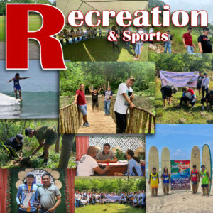
FESTIVALS, FIESTAS AND COMMUNITY ACTIVITIES
Panagkakadua-an Festival
To promote the unique brand of unity, reunions and family bonds of the people, the Panagkakadua-an Festival to be held a week before the Holy Week every three (3) years which has become a venue to promote products such as the longganisa and the chicharon (bagnet) among others.
Community Affairs
Conducted every December in celebration of the community Christmas affair, it has been an opportunity to gather the people in an assembly, recognize outstanding achievers of the community and give honor to various sectors including the balikbayans.
Foundation Day
Held every 1st of March, it is an opportunity for every San Felipenean to look back to its humble beginnings and cherish its successes and accomplishment in songs, dances and tributes ultimately to deepen the sense of pride to its people for its history and heritage.